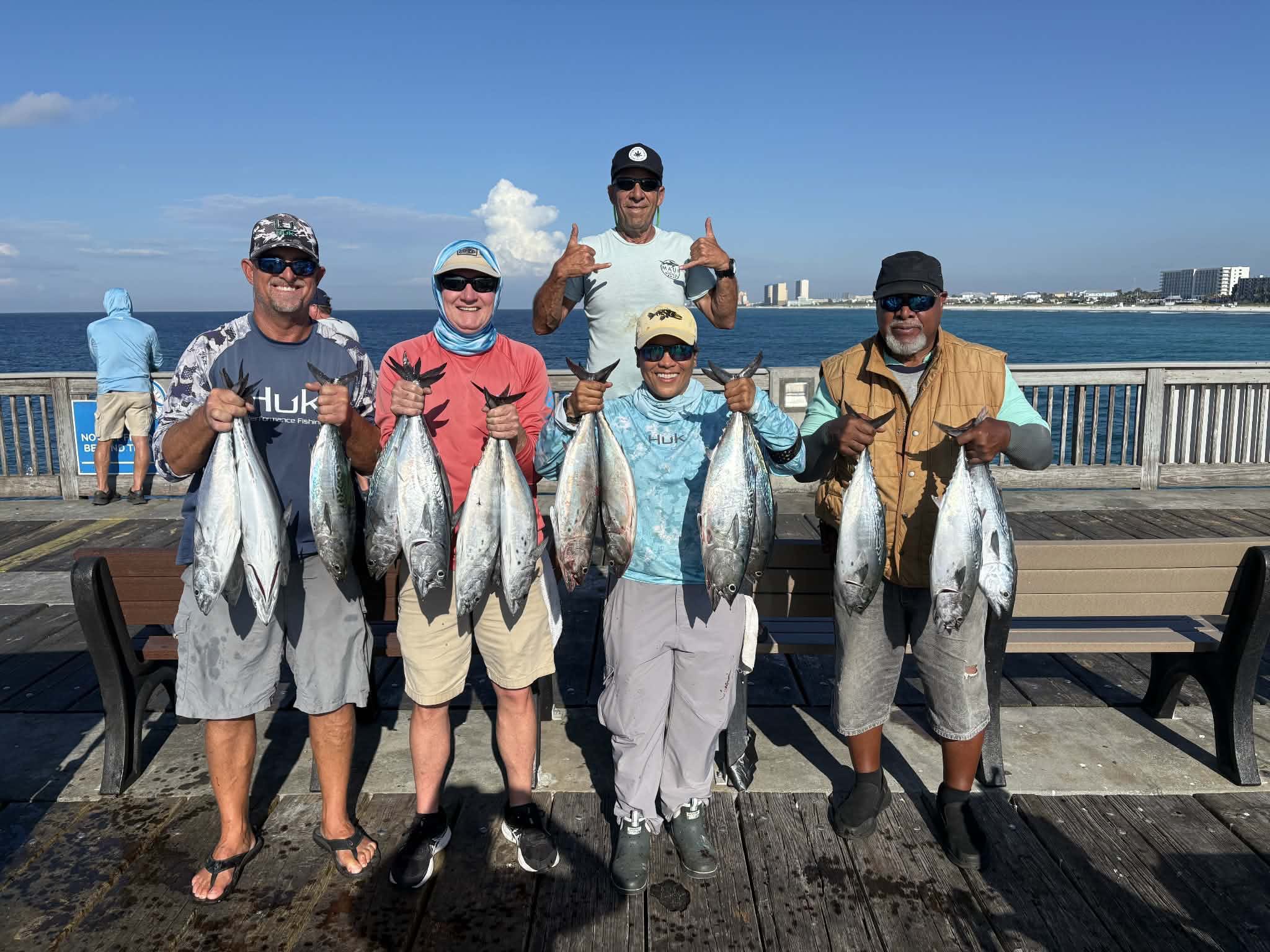
Thursday 01st. water temp 84.2 ENE 6-9mph in the a.m. / 85.3 SE 13-22mph. The water was clean. There was a good Bonita run between 0800 and 0900 this morning. Check the group picture with Rob, Sonny, Brenda, Robert and John standing in the back. The afternoon brought good catches of Spanish Mackerel and Ladyfish. Yellowtail Jacks were caught too. One small King Mackerel was hooked but lost due to getting tangled with a rod on the rail. Cigar minnows, Spanish Sardine and Alewives were available for live bait.
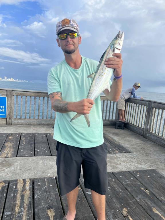
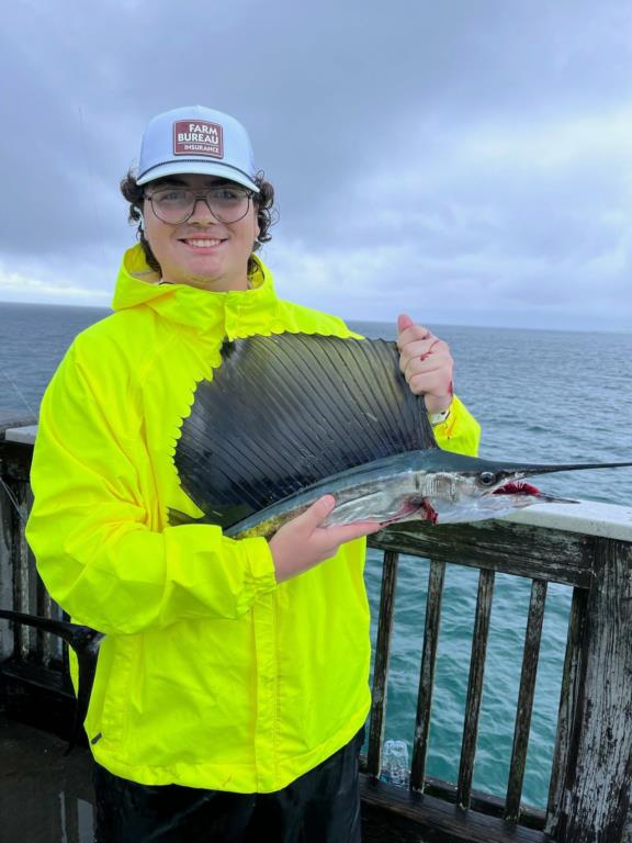
Friday: water temp 84.0 ENE 4-10mph in the a.m. / 84.0 ESE 4-10mph in the p.m. The water was clean. There were several thunderstorms with heavy rain and brief gusts of wind during the day. There were Spanish Mackerel, Yellowtail Jacks and a few Ladyfish caught in the morning. Billy caught a 5–6-foot Shark. The afternoon saw big Ladyfish, Yellowtail Jacks and lots of Spanish Mackerel. Most were average sizes but there were a few “Axe Handles”. Check this one Haden caught. I had one tiny King sky twice on my bait and immediately cut me off. Heath caught and released a small Sailfish late in the afternoon. There were Cigar minnows, Spanish Sardine and Alewives available for live bait.
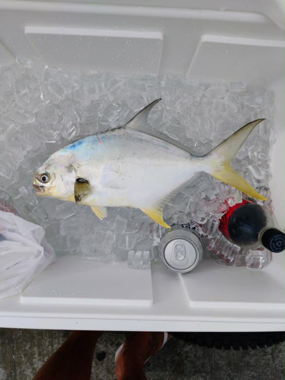
Saturday: water temp 83.5 E 5-8mph in the a.m. / 83.7 SE 7-9mph in the p.m. The water was clean. There were Ladyfish, small Jacks and a few Spanish Mackerel caught this morning. There were more Ladyfish, Jacks, Spanish and small Sharks in the afternoon. Kin caught a legal Pompano. Live bait was available.
Sunday: water temp 83.1 ESE 10-12mph in the early a.m. Then Thunderstorms moved in and the wind increased to 29mph gusting to 37 from the SE/ 82.9 ESE 3-9mph wind in the p.m. The water was clean. One small King Mackerel, Spanish Mackerel, Ladyfish, small Jacks and Hardtails were caught today.
Monday: water temp 82.9 5-9mph in the a.m. / 83.3 NE 7-15mph in the p.m. The water was clean. The weather turned the bite on. There were 8–10-pound King Mackerel, Bonita, big Spanish Mackerel, 1 small Sailfish, Pompano, small Flounder, Ladyfish and small Jacks caught. The tax man, “Flipper” was being a nuisance eating peoples catches.
Tuesday: water temp 82.9 ENE 10-20 in the a.m. / 82.8 ENE 10-17mph in the p.m. The water was clean. Today was a banner day on the pier as it seems the fall run has finally started. Corey D. (from KY with the big fish), Dusty (with his first King), James, George and Mahmoud got King Mackerel and a couple were big. Other catches included Axe Handle Spanish Mackerel (like the one Rob is holding), Bonita, Ladyfish and other trash fish. Kim got hit by a small Sailfish. Live bait was available, but the preferred bait was jerk baits.
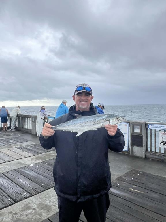
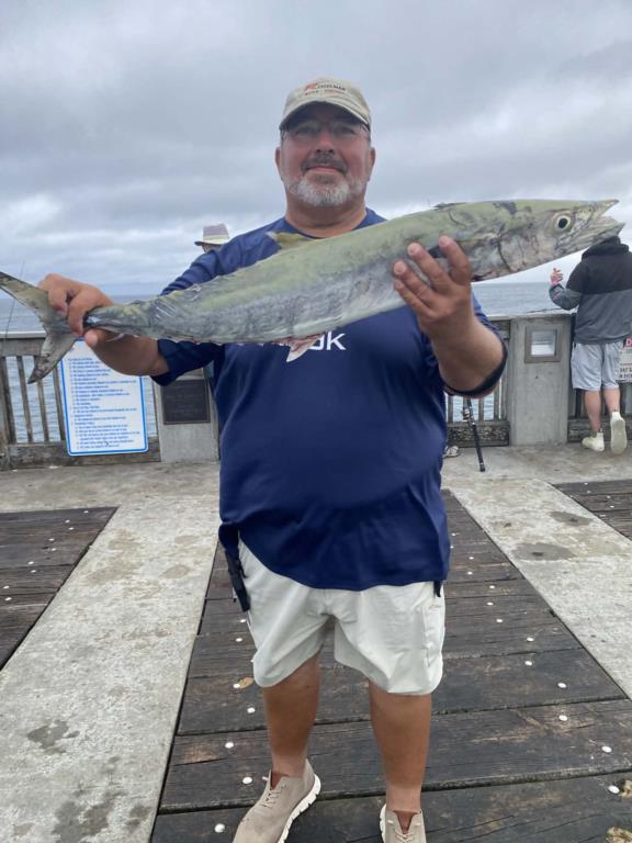
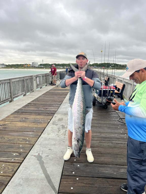
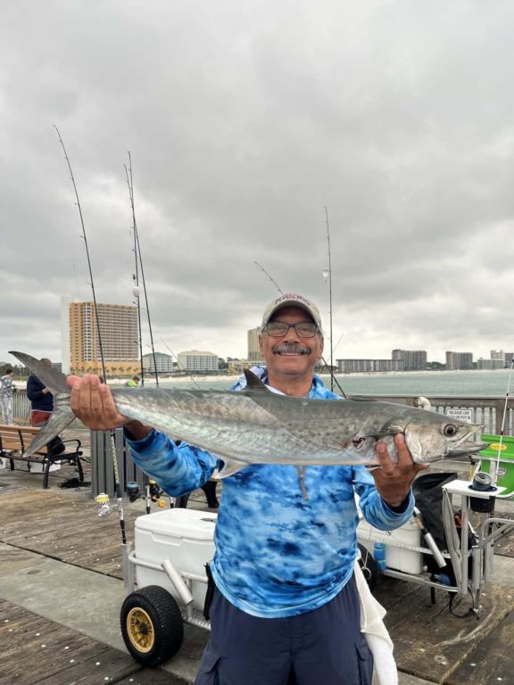
Wednesday 07th. water temp 81.5 NE 10-17mph in the a.m./ 82.0 ENE 9-11mph in the p.m. The water was clean. It was a King Mackerel day with a number of fish decked. Jason, Brenda and Kim were among the anglers who caught at least one King. A couple of anglers reached their limit. David E caught and released a small Sailfish. There were lots of live bait available.
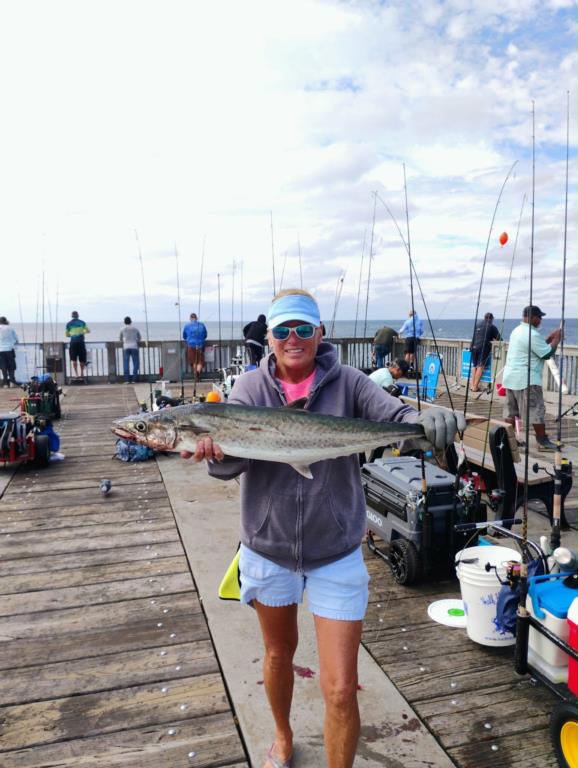
Pictures for the bulletin board: Kim with Coastal Tackle has created an e-mail for anglers to submit pictures of their pier catches. She will then print them and display them on the bulletin board at the entrance to the pier. You can submit your favorite picture here: pierfishingpics2kim@gmail.com
Red Tide status: As of the latest FWC report (Oct.?02,?2026), The red tide organism, Karenia brevis, was observed at background to very low concentrations in six samples from Northwest Florida
Tides for the upcoming week:
New Moon Saturday Oct. 10, 2026 -Full Moon Sunday Oct. 25, 3036
Sunrise: 6:40am Sunset: 6:19pm
Thursday 08th. 2 59am Low 0.9 10:11am High 1.3
4:14pm Low 1.0 10:11 pm High 1.2
Friday 4:41am Low 0.8 11:55am High 1.2
3:17pm Low 1.1 9:28pm High 1.4
Saturday 5:59am Low 0.6 9:35pm High 1.6
Sunday 7:11am Low 0.4 9:49pm High 1.8
Monday 8:22am Low 0.3 10:21pm High 1.9
Tuesday 9:29am Low 0.3 11:01pm High 1.9
Wednesday 14th. 10:33am Low 0.3 11:45pm High 1.9
Sunrise: 6:44am Sunset: 6:13pm CST
The Marine forecast for the next several days is:
THURSDAY NIGHT
Tropical storm conditions possible with hurricane conditions also possible. East winds 15 to 20 knots, increasing to 20 to 25 knots after midnight. Seas 4 to 6 feet, occasionally to 8 feet. Wave Detail: East 5 feet at 6 seconds. Protected waters rough. A slight chance of thunderstorms. A chance of showers early in the evening, then showers in the late evening and overnight.
FRIDAY
Hurricane conditions possible. East winds 25 to 30 knots, increasing to 30 to 40 knots with gusts up to 50 knots in the afternoon. Seas 4 to 6 feet, occasionally to 8 feet, building to 7 to 10 feet, occasionally to 13 feet in the afternoon. Wave Detail: Southeast 10 feet at 7 seconds and southwest 3 feet at 12 seconds. Protected waters extremely rough. Showers with a chance of thunderstorms.
FRIDAY NIGHT
Hurricane conditions possible. South winds 35 to 45 knots with gusts up to 60 knots. Seas 12 to 16 feet, occasionally to 20 feet, building to 15 to 20 feet, occasionally to 25 feet after midnight. Wave Detail: South 20 feet at 12 seconds. Protected waters extremely rough. Showers with a chance of thunderstorms.
SATURDAY
Southeast winds 25 to 30 knots with gusts up to 40 knots. Seas 11 to 15 feet, occasionally to 19 feet, subsiding to 8 to 11 feet, occasionally to 14 feet in the afternoon. Wave Detail: South 15 feet at 11 seconds. Protected waters very rough. Showers with a chance of thunderstorms.
SATURDAY NIGHT
South winds 20 to 25 knots with gusts up to 35 knots. Seas 6 to 9 feet, occasionally to 11 feet, subsiding to 5 to 7 feet, occasionally to 9 feet after midnight. Protected waters rough. Showers with a chance of thunderstorms until early morning, then showers likely with a slight chance of thunderstorms late.
SUNDAY
South winds 15 to 20 knots with gusts up to 25 knots. Seas 4 to 6 feet, occasionally to 8 feet. Protected waters choppy. Showers likely with a chance of thunderstorms until late afternoon, then a chance of showers with a slight chance of thunderstorms late.
SUNDAY NIGHT
South winds 10 to 15 knots, becoming southwest 5 to 10 knots after midnight. Seas 2 to 4 feet. Protected waters a moderate chop. A chance of showers with a slight chance of thunderstorms early in the evening. A chance of showers after midnight.
MONDAY
Northwest winds 5 to 10 knots. Seas around 2 feet. Protected waters a light chop. A chance of showers early in the morning, then a chance of showers with a slight chance of thunderstorms in the late morning and early afternoon.
MONDAY NIGHT
Northwest winds 5 to 10 knots. Seas around 2 feet in the evening, then 1 foot or less. Protected waters a light chop.
(local forecast).
THURSDAY (83/72 rain 10% wind NE 14mph
FRIDAY (77/74 rain 80% wind ENE 24mph
SATURDAY (80/73 rain 84% wind S 21mph
SUNDAY (83/70 rain 44% wind W 11mph
MONDAY (85/70 rain 11% wind NW 7mph
TUESDAY (85/71 rain 06% wind NW 7mph
WEDNESDAY(84/69 rain 06% wind NW 7mph
PIER MANAGEMENT CONTACT INFORMATION:
Bay County Parks and Recreation – 5304 Majetti Tower Road Panama City, FL 32404
850-248-8730
Vince Martin – Bay Co. Parks Division Manager - vmartin@baycountyfl.gov - 850-896-6580
Timothy Pentice- Bay Co. Asst. Div. Mgr. – tprentice@baycountyfl.gov – 448-217-4219
Tight lines and screaming drags,
Sam
SLP053@BELLSOUTH.NET
770-265-2879